Friday, September 30, 2011

NASHVILLE

September 28 and 29th, 2011  Dateline: Grand Rivers, KY USA
Once again I sat while Carol and Rich went off to enjoy themselves.  Along with the owners of MY WAY, they went off to Nashville, TN for some sightseeing. 
Rich told me that Nashville is a very interesting city compared to most that we have seen.  The city is vibrant and clean.  It is quite apparent that there is a significant amount of money in the city.  Not only has the music industry brought wealth to the community but so have the universities that are there and the extensive medical facilities.
Nashville became known as “the Music City” because of something Queen Victoria said.  Students from Fisk University, the first all Negro university in Nashville, put on a performance for the Queen introducing her to their blues music.  The Queen was so impressed that she said they must have come from a “Music City”. That name has stuck ever since.
In Bicentennial Park which was created for the state’s 200th anniversary, there is a black granite wall called the “path of history” that records the history of Tennessee from the earliest of time until 1996, the state’s 200th year as a part of the union.  One interesting fact on the wall was that in 1918-19 the Moon Pie was created in Chattanooga (You sure can tell where Rich’s interests are). For those who don’t know Moon Pies, they are marshmallows sandwiched between two chocolate cakes then the whole thing is dipped in chocolate.  They are so good, but not very healthy


The park also had a set of 50 bell carillons, one for each state. The carillons contain an aggregate of 95 bells representing the 95 counties of Tennessee.  The bells can play different tunes as they can be programmed from an onsite control room. While Carol and Rich were at the bell towers there was also a visiting group of retired sailors.  The bells were set to play the Navy Hymn, “Anchors Away”. Otherwise, every hour on the hour, the bells play a Tennessee themed song such as “The Tennessee Waltz”.
In Centennial Park (1896) the 100th anniversary of Tennessee statehood there stands a full size replica of the Parthenon in Greece.  The structure is immense and is nearly exact.


Thomas Ryman, a very wealthy riverboat captain, had a major impact on the city.  He built a saloon which still stands today.  He called it the Silver Dollar Saloon and he embedded silver dollars in the floor.  The floor is still visible today as are the silver dollars that he embedded.  The floor does have some indentations in it where it was struck by errant bullets.  Today it is the Hard Rock CafĂ©’s souvenir shop.  Ryman also built a church which later became the Ryman Auditorium and later the Grand Ole Opry. The Grand Ole Opry has now moved out of downtown Nashville and is located next to Gaylord Opryland Resort along the Cumberland River. What once was the Grand Ole Opry in Nashville is now back to being Ryman Auditorium. It too has country and western concerts.
The main street in Nashville’s downtown is called Broadway.  It is lined with Honky Tonk bars where the music starts at 2 in the afternoon and goes on for the next 12 hours.  Besides Honky Tonks there are MANY cowboy boots and hat shops.  Rich liked this sign.

The skyscrapers there are very unusual.  The AT & T building was in the Batman movie and so is called the Batman Building.  The US Bank building, as you can see, has numerous projections sticking out the sides
Tomorrow will be a rest day.

Thursday, September 29, 2011

NOTHING IN PARTICULAR

September 27, 2011  Dateline: Grand Rivers, KY USA
I have not traveled in a week, so I don’t have anything to report on my travels.  Today, Rich had the oil as well as the oil and fuel filters changed on my engines, transmissions and generator.  In a car that is an easy task but for me it takes 4-5 hours to get the job done.  I take 20 gallons of oil, three oil filters and 8 fuel filters---my diesel must be clean and not have any water in it.
Last night Rich organized a get together for the Loopers who are staying in Green Turtle Bay Marina.  The turnout was really good. There must have been about 26 people there, which considering there were about 17 Looper boats at the marina is pretty good.
Last Sunday, friends of MY WAY took Rich and Carol and Francine and Wayne to Barkley Lake Inn for a buffet lunch.  Barkley Lake Inn is run by the State of Kentucky and is a large resort and conference center. It has houses to rent as well as lodge rooms, a marina and conference rooms.  The buffet was outstanding and the view of the lake from the dining room was beautiful.
 Today, Rich and Carol went with Wayne and Francine to the Homeplace which is an 1850’s living museum in Land Between the Lakes Park.  The museum was interesting but not very exciting.  The buildings were original 19th Century structures that had been relocated to the site from other areas in Kentucky.  The construction of the buildings is interesting as the corners were dove tailed together.  The beams used to build the structures were very large.  One can only imagine how large the trees were that the beams were cut from.  The virgin forests in the area must have been beautiful to behold.
The road through the center of the Park has a number of signs on it pointing the direction to various family cemeteries.  When the Park was formed the Federal government purchased the land but allowed those people living on the land to remain until they passed away, so family cemeteries remain in the Park.

Sunday, September 25, 2011

HE IS A YEAR OLDER

September 23, 2011  Dateline: Grand Rivers, KY USA

Today Rich continued to clean me, kind of boring, huh?  This is proving to be a big job. I would bet that as soon as he gets finished,  it will begin to rain.  MY WAY was also getting cleaned.

Today is Rich’s birthday, he is getting older by the day.  In the evening, the owners of MY WAY, Wayne and Francine along with friends of his named Sam and Lee as well as Carol and Rich went to the Marina’s restaurant to celebrate.  Wayne and Francine brought a cake with them and everyone got to have a piece.  It was an enjoyable evening.
Wayne & Francine

Francine took this picture as our anchors were being pulled up in Little Diversion Canal, what do you think was going on Carol’s mind?  Looking at the fog in front of the boats she must have been asking if Rich and Wayne were crazy.

Saturday, September 24, 2011

BBQ BY THE RIVER

September 22, 2011  Dateline: Grand Rivers, KY USA

In the morning Rich began my cleaning process.  After 3 months on the water and having traversed more than 80 locks without a good cleaning, I had gotten pretty dirty.  Carol had been complaining that she had never seen me so dirty. 

Midway through the day everyone left me and went to Paducah. This was not a good day for pigs and hogs. Paducah, KY has an annual event which involves the full commitment of pigs and hogs.  The event is a barbeque cook-off that lasts for three days.  There must be more than 50 vendors selling smoked  barbeque pork ribs, chicken, turkey legs and other great food.  They sell about 60 tons of barbeque at the event each year. Some of the stands are simple, with nothing more than a table whiles others are full dining rooms.  The entire event is for charity.  People attending get to vote for the best barbeque then large trophies are awarded.  The vendors display their trophies and awards with great pride.  Of course those places with the largest number of awards and banners get the most business with the longest lines.  There are all kinds of fried foods there as well.  There is fried ice cream, fried oreos, fried bananas, and fried pies. 
Paducah was founded around 1815 at the point where the Tennessee, Cumberland and Ohio Rivers merge together.  It was named after an Indian Chief Paduca who had lived in the area.  The town’s grid was laid out by William Clark of the Lewis and Clark expedition.  When Clark officially opened the city he invited the Chief to the ribbon cutting, but the Chief died on the way of a European disease.   The city remains a key to river travel today.  It is not only the headquarters to one of the large tow companies but also has the training school where tow captains learn how to drive tows in a simulator.  Rich and Carol had dinner at the Paducah fest with a gentleman and his wife who relocated to Paducah from New Jersey. He said he had operated the simulator once and said it was very easy to get in trouble in St. Louis because of all the river traffic and congestion there.
Paducah has a flood wall to protect the city when the Ohio River rises above its banks.  The town has painted murals on the wall to make it look attractive. There are huge gates that, while allowing the public access to the river side of the wall, can be closed to keep the water out of the city.
The old buildings downtown show what and who was once there.  There is a building inscribed with “ American German National Bank”, the bank has long ago closed but the structure still stands.
 Paducah is also home to the National Quilt Museum. Paducah is known as “Quilt City, USA”. The museum hosts many events including changing exhibits, workshops, appraisals, traveling exhibits. It also accepts donations of old quilts.

Friday, September 23, 2011

NORTH SOUTH EAST AND WEST

September 21, 2011 Grand Rivers, KY USA
I got up early today because I had 138 miles to travel from Little Diversion Canal to Green Turtle Bay Marina in Grand Rivers, KY.  I would travel on the Mississippi, Ohio and Cumberland Rivers and travel through 3 locks.
During the night while Rich and Carol slept I could feel the dew forming on me.  When they finally got up to get me ready for the 7 AM departure time they found I was sitting in a fog bank.  So, I sat for the next hour and a half waiting got the fog to lift. We finally left at 8:30.
The trip down the river was fun, I could really fly with the current pushing me forward.  I was doing well over 22 miles per hour.  There were not many tows so I didn’t have to slow down at all.  Going around a corner a call came over my radio.  A small tow had gone aground and he asked me to put out a big wake in hopes it would lift him high enough to get going again.  I tried my best, I know I can put out one heck of a wake.  I don’t know if it worked, but the tow thanked me.
I saw much bigger tows than I had seen before, One I saw had 31 barges that he was pushing up stream.  Given the standard size of a barge, that tow was 175 feet wide and 1200 feet long.  Pushing against the current that tow was sure churning up the river and he was only moving at 4 knots.
Most people think that the Mississippi River flows from north to south, it does, generally.  In some places it flows east, it other places west, and others north, then south again.  In some places the river meanders forming horseshoe bends and creating places of multi directional flows.
Next came the Ohio River and I had to turn up steam, what an awaking.  I went from 22 miles per hour to 16 as I now was traveling against the current.  The Ohio River at Cairo, IL, where the Ohio and the Mississippi come together, is a major staging area for barges and I had to travel very slow as there were barges and Tows on both sides of the river and in the middle.

The two locks on the Ohio that I would have to go through are controlled by wicket dams.  Depending on the level of water in the river the wickets can be raised or lowered.  When lowered, boats and tows can travel right over them. When raised, they must travel through the associated lock.  The first wicket dam was down so we were able to go right over it.  I was not so lucky with the second lock.  I had to wait for about 45 minutes as a tow cleared the lock.
Finally, I got to the Cumberland River.  The Cumberland River is narrow and the banks are steep.  I passed several quarries along the way with tows tied up along them.  I didn’t’ see very much boat traffic, except for one bass boat that came charging at me putting out a large rooster tail. I slowed down but he did not.  He hit my wake and the boat was launched into the air.  I thought he was going to flip over backwards, he did not.
I got to the last lock, the Barkley Lock and Dam.  I had to wait an hour for a tow to clear.  As I waited I watched the sun go down.  The lock is a “new one” and is a 57foot lift.  The chamber is huge.  When I emerged from the lock it was dark. Luckily I had only half a mile to travel.  That was the good news.  The bad news was that I had a winding channel to travel in the dark with no moonlight or shore lights.  Fortunately, MY WAY knew where we were going and could lead the way to Green Turtle Bay Marina.
I will be in Green Turtle Bay for the next two or three weeks

I ANCHOR OUT

September 20, 2011  Dateline: Little Diversion Canal, IL USA
I left Hoppies marina in the morning for the 110 mile run to Little Diversion Canal.  The Canal is a small cut at mile 48 on the Upper Mississippi River’s right descending bank.  The trip down the river was very uneventful and the 3-4 knot current made the trip even faster. 
The Mississippi River looked somewhat like the Hudson River with high vertical cliffs coming straight to the river’s edge, just like the New Jersey Palisades.  The leaves of the trees on the side of the cliffs, the west side of the river, are beginning to change color.


I got to the Canal before MY WAY and Rich steered me in.  It was a challenge to get into the canal as the same strong current that pushed me down the river now fought me as I turned and went back up stream.  I got into the Canal and Carol went to put my anchor down.  Ooops, the circuit breaker tripped and my anchor would not go down.  MY WAY came into the Canal, then Rich and Wayne tied me and MY WAY together. MY WAY ‘s anchor held strong enough to hold both of us in place.  Carol searched my manuals and found where the breaker was located.  Rich reset it and down the anchor went. I held well in the mud but Rich and Wayne decided to stay tied together for the night. That made it very easy for all to get together for cocktails at 5.  We were all tired and at the end of the day it was good to call it a night.  
The Canal is just south of Cape Girardeau.  Like many towns along the rivers, levees or walls were constructed to keep back the flood waters.  The wall in Cape Girardeau has a mural painted on it. These walls may also have doors in them to allow access to the river.  In this picture you can see the mural as well as one of the doors being open.

Tomorrow I am off to Green Turtle Bay Marina in Grand Rivers, KY

Tuesday, September 20, 2011

ST. LOUIS FROM THE WATER

September 19, 2011  Dateline: Kimmswick, MO USA
Rich bought me some fuel this morning and then we headed off to the Melvin Price lock about a mile down river from Alton, IL.  MY WAY  left the marina first  and entered the lock ahead of me. There was one other pleasure craft in the lock already and then another two boats followed me in.  This was my first lock on the Mississippi River and it was huge.  Tows on the Mississippi are larger than those on the Illinois so the locks need to be much larger.  After leaving this lock I then went slow so that all five of us would get to the second lock at about the same time and I would not have to wait for the slower boats to arrive.  Before arriving at the second rock I had to proceed through a narrow canal that goes around an area called The Chain of Rocks, just the name scares me. The canal was built to bypass a portion of the Mississippi that has rapids.
I sailed past St. Louis and Carol got this picture of the Arch and the court house where the Dred Scott case was tried.


She was also able to get a picture of the Lewis and Clark statute that is located by the river.  Because it is located so close to the river it gets covered with water periodically.

I ended my day at Hoppies Marine Services located in Kimmswick, MO.  Hoppies is the last place to get fuel for the next 270 miles.  Hoppies is located along the side of the river and consists of several barges tied together.  Every day at 4:30 Fern Hoppy holds court in a covered area of the fuel barge and tells those heading down stream where the hazards are in the river and where the safe anchorages are located.  In attendance this afternoon was a man who was heading down the river in a 20 foot center console with an outboard engine.  He was very concerned about his ability to have sufficient fuel onboard to make the next 270 miles.  After talking with Fern, who is about 75, he felt more comfortable but was still concerned about the best route to take.

Tomorrow I am off to Little Diversion Canal, 110 miles down the Mississippi. MY WAY and I will anchor out, so there will be no posting to the blog as there will be no internet access.

Sunday, September 18, 2011

ALTON, IL

September 18, 2011  Dateline:  Alton, IL, USA
I left Grafton, IL this morning at 9 AM and in an hour and half I was in Alton.  The trip was a slow because of the rain that was falling and the limited visibility.  I went close to the Limestone Mountains and Carol got this picture showing the effects of the river on the cliffs.


The real target for today, I learned, was the Argosy Casino in Alton.  Carol, Francine and Wayne went to the casino and Rich stayed behind. (Rich doesn’t gamble). Rich came over later and they all had a wonderful dinner at the casino’s buffet. Only Wayne came back a winner.


Tomorrow it is off to Hoppies’ about 60 miles and two locks down the Mississippi River.

HAPPY BRITHDAY GRAFTON

I asked Rich to write today’s blog posting as all I did was sit in my slip and wait for Rich and Carol to return.  Grafton, IL was founded by James Mason in 1832 at the point where the Illinois and Mississippi Rivers meet.  The town flourished building ships, fishing, and providing limestone for several structures in the area, including the Eads Bridge, which was the first bridge to cross the Mississippi River at St Louis.  Mussel shells from the rivers provided the raw materials for a once thriving button industry in Grafton.  The town at one time had a population of 10,000 but it now has approximately 650.  Street signs throughout Grafton indicates that the Grafton area is the wintering home of Bald Eagles from December 1 to March 1.
In 1993, the Illinois River at Grafton was 38.5 feet above its normal stage.  Grafton is sandwiched between Limestone Mountains and the river. The height that the river reached in 1993 can be seen by the sign on the side of the building which is located next to the river. Of course while Salt ‘n Sand was there the river was anywhere from 1 – 2 feet below normal.

Grafton celebrated its 175th birthday on September 17th with a full day of events starting with a parade and ending with a glorious fireworks display.  The parade included several bicycles that were made to look like whimsical animals including sea horses and lobsters.  The Real Housewives of Grafton even had a float.   There was a boat parade, Salt ‘n Sand did not participate.  Other events included a dog jumping display.  Labrador Retrievers would run up a ramp and jump into an aquarium that was actually a truck trailer.  The trainer of the Labs set some children in just the right place so when the dogs hit the water the splash would go over the side and land on the children.  Everyone had a good time.
Salt ‘n Sand back for this session. There were 10 other Looper boats in Grafton Marina and Rich invited them all to watch the fireworks at night, because I had one of the “best seats” in the house.  The owners of three other boats came and they had a good time exchanging experiences.  The Looper boats are beginning to bunch up as they try to adjust their schedules to get to Joe Wheeler State Park in Alabama for the rendezvous by the end of October.  Some of the owners are spending extended time at either Grafton or Alton marinas before they begin the trip down the Mississippi where there will be several days of anchoring before there are any marinas.
Each morning that I awoke in Grafton, I found myself covered with May Flies.  I did not like it and Rich would hose them off.  There were some small birds flying around me each morning to feed on the May Flies. They were my friends.  Carol was able to get this picture as one of the birds touched my sun shade and plucked a May Fly off.

Tomorrow I will be off to Alton, IL

Friday, September 16, 2011

RAIN AND BEER

September 15, 2011  Dateline:  Grafton, IL USA
I woke on September 14, to rain and that is what it did the entire day.    Rain, rain and more rain, but Rich and Carol got my insides cleaned and Carol was able to edit some video that she took of the LST.  That night, Rich and Carol had a great Corned Beef and cabbage dinner on MY WAY. 
  The picture of the marina I am at shows how high the water can get on the Illinois River.  Notice the height of the pilings. This entire marina floats including the ships store so that  it goes up and down with the level of the river.


Today, Rich and Carol went with the owners of MY WAY to St Louis.
Based upon a friend’s recommendation, they first went to an area in St. Louis called “THE HILL”. It is an Old Italian neighborhood with many wonderful restaurants. They said they went to “Cunetto’s House of Pasta”. It was a scrumptious lunch. They had cannelloni stuffed with seafood, pasta covered with buttered cauliflower and mushroom cream sauce, pasta with Bolognese sauce, and finally Italian sausage with peppers and onions and a side of pasta.
They then went on a tour of the nearby Budweiser brewery. The facility is huge.   It produces some 18.5 million barrels of beer a year.  A barrel of beer is 31 gallons.  Do the math, that’s a lot of 12 oz bottles.  The tour lasted 1 ½ hours as the guide told the history of Anheuser-Busch and showed them through the facility.  During Prohibition, Anheuser-Busch branched off into other products including NEAR BEER.  Those products enabled the company to remain in business and when Prohibition was repealed they were ready to start shipping beer immediately.  The plant grew up around an elementary school that Mr. Busch attended.  When the city decided to sell the school, Mr. Busch purchased it and made his third grade classroom his new office.  The building ultimately became the Company’s administrative headquarters.
The tour also included a visit to the on-site stables for a few of the company’s Clydesdale horses. The company has several teams throughout the country that appear in many parades and celebrations. They have a breeding facility in Boonville,Missouri
The tour ended in the company’s hospitality room. Each person on the tour was allowed 2 glasses of their favorite beer or any other company product. I heard there was 4 glasses of Root Beer and Pepsi on this party’s table.  I guess 3 PM was too early for a glass or 2 of beer?
St. Louis was the Gateway to the West and to recognize that, a 630 foot high stainless steel arch was built.  The arch has an observation area at the top.  There are small pods that hold 5 people that take you, like an elevator, from the bottom of the arch to the observation area.  Needless to say the view from the top is terrific.

View from Top of Arch


It is also somewhat sad to see what has happened to St Louis.  The number of burned out and boarded up building is beyond belief and that does not take into account East St Louis on the Illinois side of the river, which is noted for its poverty and destroyed buildings.


The Illinois River bank near Grafton is lined on the Illinois side with high limestone cliffs. Driving a  car down the highway on the Illinois side one can easily see how high the river once was and how it carved and eroded the limestone cliffs.  There were caves and carved out areas created where the water swirled.  The rock history recorded in the carved rock is 70-80 ft above the current river level. 
The area here is much like New Jersey. The leaves on the trees are beginning to turn and the temperature has been dropping at night.  Overnight temperatures are falling into the 50’s

Tuesday, September 13, 2011

A BOAT DESIGNED TO BE GROUNDED GETS GROUNDED

September 13, 2011  Dateline: Grafton, IL USA
Here is a picture of the marina that MY WAY and I stayed at last night.

Yesterday, while on my way to Beardstown, I saw LST 325 pulled up on the shore in Peoria.  I asked Rich to do some research and find out about her.  LSTs (Landing Ship Transport) were used in WW II to land trucks, tanks and other equipment on beaches.  They were equipped with anchors on the stern so between pulling on anchors dropped on the way to the beach and their propellers they could back On June 5th 1944 LST 325 sailed from Falmouth, England carrying elements of the 5th Special Engineer Brigade. LST-325 was part of Force "B", the back-up force for the troops going ashore at Omaha Beach on June 6th. On June 7th they anchored off Omaha Beach and unloaded the men and vehicles onto smaller landing craft. Between June 1944 and April 1945 LST-325 made 44 trips between England and France, unloading at Omaha, Utah, Gold, Juno and the city of Rouen on the Seine River. Twice they carried loads of ammunition from Omaha Beach to St. Michel on the western shore of the Cotentin peninsula for the Army besieging the port city of Brest.  LST 325 like other LSTs did not have a name only a number.  In 2000 she was acquired by The USS Ship Memorial, Inc., and sailed back across the Atlantic for the final time. She arrived in Mobile, Alabama on January 10th 2001 to begin a restoration by retired Navy volunteers.  She is one of two that have survived.
Today she came down the Illinois River on her way to visit another port. She must have tried to give me some room as she passed by my berth at the barge.  Well she got stuck in the muddy river bed.  Her captain put her in reverse and her propellers ground away at the river bottom until she could back away and then go forward again.  I bet she didn’t bend her props.

Later down the river I saw her again pulling into her next port.  As she pulled in, she opened her bow and was getting ready to put her landing ramp out.  It was cool.
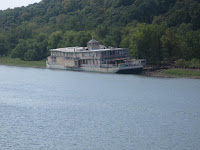
Later in the day, I saw this river boat on the left in the process of being restored.  It sure looks like there is a lot of work to be done.

Some of the tows I saw along the way have their bridges on hydraulic pistons so that they can get under bridges easier.  This picture shows one of the tows with its bridge in the up position.


When Rich went to check in at our stop for the day (Grafton Harbor), he was told that if he paid for four days slippage I could stay for seven.  Looks like I will be here for the week before I start my trip down the mighty Mississippi River.
 

THE LAND OF LINCOLN

September 12, 2011  Dateline: Beardstown, IL USA
I left Peoria a little after 8 this morning, and within 45 minutes I had traveled to the Peoria Lock.  I sat at the lock for 2 hours while I waited for a tow to clear the lock.  Once we cleared the lock MY WAY and I got on our way.  We had 88 miles to go today to get to the barge at Beardstown where we would tie up to for the night.  There were two railroad bridges that had to be lifted so I could pass underneath.  I was lucky because both bridges were able to be opened as soon as Rich called. The second bridge had a long freight train go over it about 30 minutes after I cleared it, boy, was I lucky that I did not have to wait for that train.
I passed through Havana today. Because MY WAY is Canadian it is ok for her to go there, but I didn’t think that I could.  Then I learned that this Havana is in Illinois and not Cuba.


The dock in Beardstown is a couple of barges tied to shore below a 30 foot wall which keeps the river out of the town when it overflows it’s banks.  There are no services, and I mean no services, no water, no electricity and I am tied to the clamps that hold the covers on one of the barges.  It is a different life style, but I am happy to be here, because without the barge I would have had to travel some 168 miles today.
Beardstown was founded in 1829 and was the site of Abraham Lincoln’s Almanac case.  Rich and Carol got to go into the court room where President Lincoln defended William Duff Armstrong and they saw the jail where Duff was held for eight month before the trial.  Lincoln used the almanac to discredit a witness and win freedom for his client. 
President Lincoln and Stephen Douglas had one of their famous debate in the Beardstown public square in 1858.
Beardstown is located in Illinois near the Indian burial mounds.  The town’s museum contains 8 picture frames about 2’X4’ in size that are full of Indian arrow heads.  The arrow heads within each frame are arranged in different patterns and are very attractive. 
Beardstown is also known as the watermelon capital of the nation. The watermelons that grow here are shipped to every major city in the country.  Cargill Pork has a processing plant in the town employing some 2,200 people and processing 19,000 hogs a day.
Tomorrow I am off to Grafton, IL about 88 miles further south west where the Illinois meets the mighty Mississippi. 

Sunday, September 11, 2011

FOG

September 11, 2011  Dateline: Peoria, IL USA

I woke up early this morning to thick dense fog.  I knew I had 80 miles to go and really wanted to get going, but the fog was so dense that I had to stay put.


I had only one lock to go through today and I was lucky.  As I got close to the lock Rich called the lock master and was told that he would start filling the lock for MY WAY and me.  The lucky part was that as we got to the lock an Army Corp of Engineers tow called and said he would like to pass through the lock in about 30 minutes.  US Government vessels always get first priority. As we left the lock another tow was approaching up bound, he would have been given second priority.  Arriving 30 minutes later would have cost us 2 ½ hours as both vessels would have had priority over me and MY WAY.

Along the way I saw some different formations of trees.  The first picture shows how the river has eroded away the soil from around the roots of the trees.  The second picture is a pretty area of the Illinois River where the river has not eroded the bank away.
Last year Rich installed an Automatic Identification System (AIS) on me.  It is a transponder and broadcasts information about me and also receives information from other boats that are equipped with the same system.  One of the bits of information that is transmitted is the boat name.  Rich can call ahead to tows like Gladiator in this picture and arrange the place where it is best to pass him.  The tow captains seem to appreciate that they are called by name and of course they know my name as well.
I passed the entrance to Hamm’s Holiday Harbor along the way. It advertises deep water, but no fuel or transient dockage.  It looks to me like there were so many boats there that they were parked on the ground.  I guess they sailed up on the edge when the river flooded and then when it receded they just stayed there.  I could not tell if any of them were for sale.  Hamm’s is really a yard for wrecked boats, I don’t want to go there.
Rich and Carol started the day by watching the 9-11 ceremonies in New York and Washington on television.  The day ended with red roses floating in the Illinois Valley Yacht Club marina in memory of those who died on this day 10 years ago.  I was only 9 months old but I also remember the day all too well.
Tomorrow, another 80 mile day to tie on to a barge at Beardstown, IL.